
ASM Geospatial empowers the construction industry with cutting-edge drone mapping services designed to streamline every stage of your project.
From initial site surveys to progress monitoring and final inspections, our precise 2D maps, 3D models, and topographic data provide the insights needed for accurate planning, design, and execution. Our solutions save time, reduce costs, and ensure your projects stay on track and within budget.
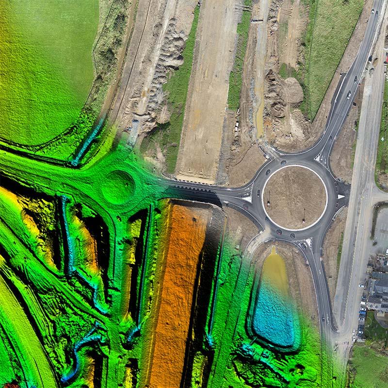
By using state-of-the-art drones equipped with high-resolution cameras and sensors, we capture detailed aerial data quickly and safely, reducing the need for traditional surveying methods. Whether it’s tracking site progress, assessing earthworks, or verifying as-built conditions, ASM Geospatial delivers the data and accuracy you need to make informed decisions and deliver exceptional results.
Ready to
get started?
Simply book a 1 to 1 Consultation to discuss your requirements and receive a no strings attached quotation.
 Splash