
Analysis
At ASM Geospatial creating the map is only the beginning; our engineering background allows us to interrogate the map further than ever before. We can analysis your terrain to deliver outputs that suits your needs and solves your problems.
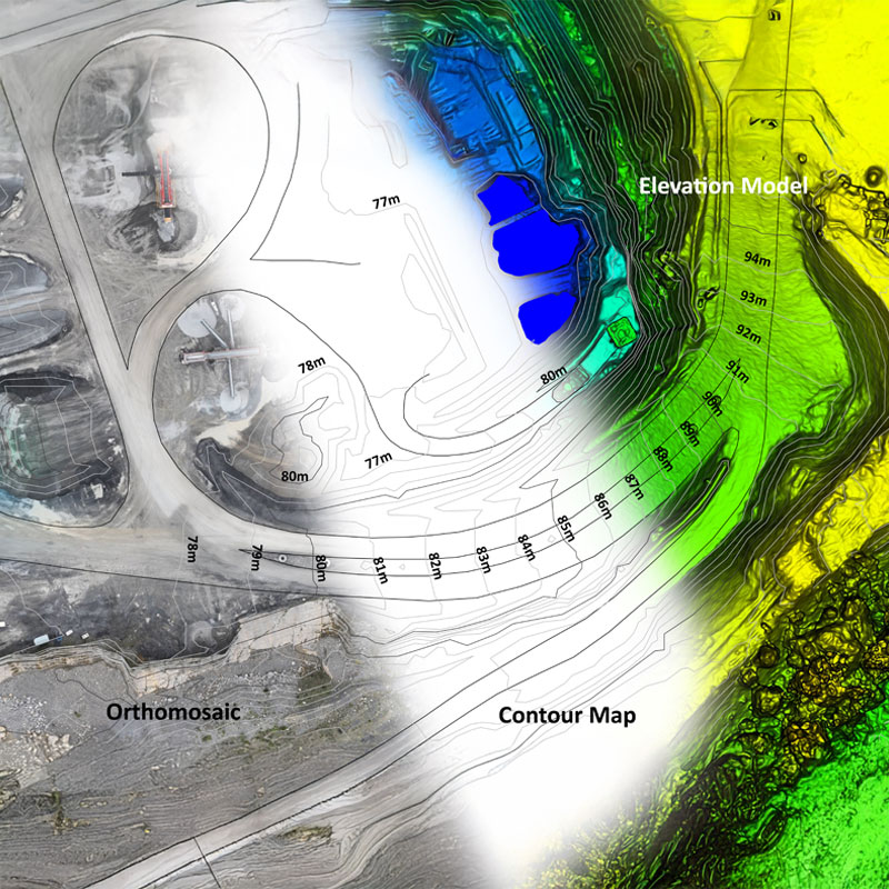
Topographic Surveys – Planning
The Orthomosaic and Elevation model are the main components in developing a Topographic Survey Map, using this data and our experience we can manually draw all of the relevant site details and generate annotated contours at specific intervals over the entire survey area.
The site coverage achieved using a drone means that no detail is missed and often information thought irrelevant at the time of collection becomes invaluable in the future. We can output these maps in traditional Autocad formats for use in site design, planning applications or as built surveys.
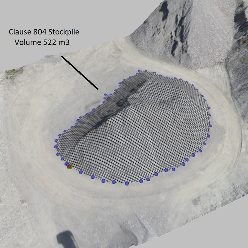
Volumetric Analysis
The accurate 3D Model data allow us to perform complex volumetric analysis, calculating such information Stockpile or Reserve volumes, our services have also been regularly deployed to track cut/ fill operations in large construction projects.
Our background in Earthworks projects allows us to take your design and create a Design Surface 3D Model to provide fast and direct comparisons.
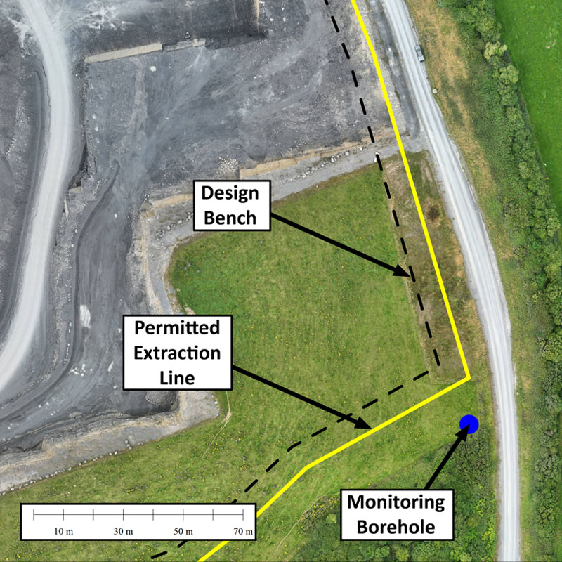
Planning Compliance & Environmental Monitoring
Drone surveys give a unique perspective to any project, the ability the accurately overlay critical planning or environmental information allows our clients to keep track of their projects and avoid costly errors.
Maps can also be made detailing the locations of critical environmental monitoring location points or even site utility services.
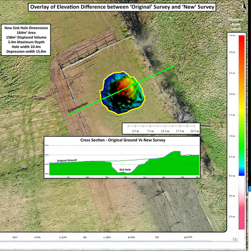
Change Detection
The vast amount of detail captured in each survey allow us the accurately track change over time. Our services have been utilised to detect change in areas such as coastal erosion mapping and even underground mine failure over 100’s of acres.
Sinkholes and Crownholes can be quickly identified ensuring the safety of both people, livestock and property. Repeated surveys allow the rate of change of deterioration to be also tracked.
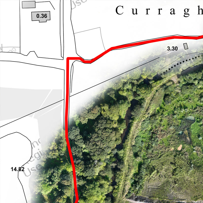
Legal Boundary Mapping
Although state boundary mapping in Ireland is non-conclusive the ability to overlay complex ownership boundaries onto hi resolution photomaps often adds important information into the process of dispute resolution.
Our experience allows us to overlay old deeds maps to enhance the picture. They can also be used start the process of ownership transfer.
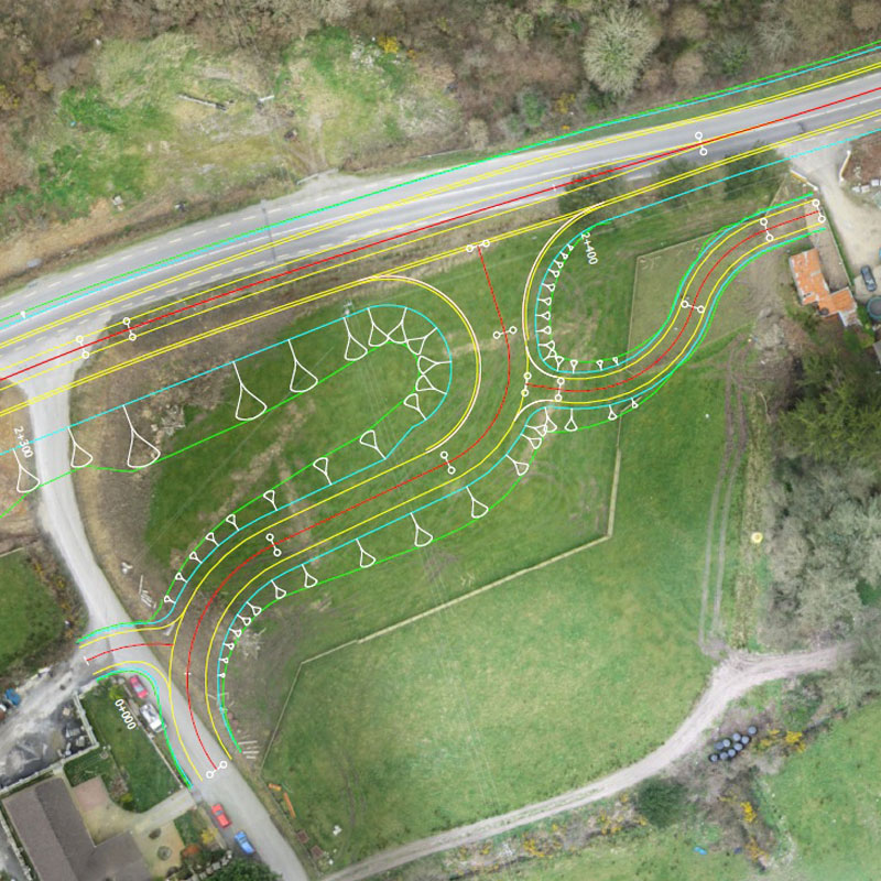
Construction Planning
Construction projects are often complex endeavors, organizing and coordinating all aspects of a project from inception to completion is vital for success. A drone survey can be used in a variety of ways during a construction project, firstly design plans can be overlaid on the Orthomosaic to identify costly clashes early, resources can be allocated accurately and the recording of preconstruction elevations can minimize disputes at a later date.
Regular surveys throughout a project allows complete timeline of events to be document allowing for accurate and timely payment.
Ready to
get started?
Simply book a 1 to 1 Consultation to discuss your requirements and receive a no strings attached quotation.
 Splash